
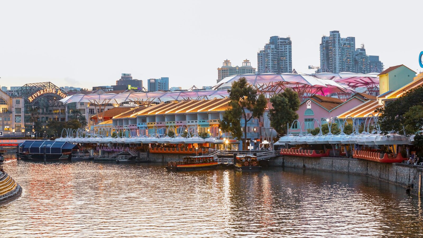
Boat Quay and Clarke Quay curl along the Singapore River in the heart of the city, two stretches of restored warehouses and shophouses that once formed the beating heart of the island’s trade. Understanding Boat Quay Clarke Quay history in Singapore means going back to the river itself, the narrow, tidal waterway where the modern port began. For much of the nineteenth and early twentieth centuries, this was where goods arrived, were unloaded, stored, traded and shipped onward, and where a whole working world of merchants, boatmen and labourers lived and toiled. Today the same buildings hum with restaurants and bars, but the bones of the old river trade are still there to read.
This guide traces how the two quays grew, what the river meant to early Singapore, what remains today, and how to enjoy the area with a sense of its past.
The River That Made Singapore
When the settlement grew in the early nineteenth century, the Singapore River was its lifeline. Ships anchored offshore, and their cargo was ferried up the river on small lighters and bumboats to be unloaded at the quays. Godowns, the warehouses that lined the banks, stored rice, spices, rubber, tin and countless other goods passing through the entrepot port. The river was crowded, noisy and endlessly busy, packed so tightly with bumboats that people said you could almost cross from bank to bank by stepping across them.
Boat Quay occupies the south bank along a curve of the river. The bend was considered auspicious in feng shui terms, resembling the belly of a carp, and it became one of the busiest commercial stretches in early Singapore, dense with the offices and warehouses of Chinese merchants and traders. Coolies carried sacks and crates on their shoulders between boat and godown, and the shophouses behind held the businesses that ran the trade. This working riverfront was the engine room of the colony’s commerce.
Boat Quay and Clarke Quay Take Shape
Clarke Quay lies a little further upriver, named after Sir Andrew Clarke, an early colonial governor. Like Boat Quay, it grew as a zone of warehouses, boatyards and businesses tied to the river, though it developed its own mix of trades. Together the quays formed a continuous working waterfront, linked by a series of bridges that let people and carts cross the river.
Those bridges are part of the story. Several historic crossings span the Singapore River near the quays, including old bridges that carried road and foot traffic between the banks and helped knit the trading districts together. Walking the riverside today, you pass several of them in a short stretch, each a marker of how the city organised itself around the water.
By the later twentieth century the river trade had faded as modern container ports took over, and the waterway had grown badly polluted. A major, multi-year clean-up of the Singapore River in the 1980s transformed it, removing the old cargo activity and pollution and reimagining the banks. The godowns and shophouses, no longer needed for storage, were conserved and repurposed. Boat Quay became known for its riverside restaurants, while Clarke Quay was redeveloped into a dining and nightlife destination, its old warehouses given new uses under bright canopies.
What to See Along the Quays Today
The pleasure of the quays now is that history and leisure sit side by side. A riverside walk takes you past conserved buildings whose scale and rhythm still speak of their warehouse origins, even as they house very different businesses.
A few things to look out for:
- The shophouse and godown facades. Behind the awnings and signboards, the old buildings keep their proportions, shuttered upper windows and five-foot ways. Reading them helps you picture the working river.
- The river and its bumboat rides. Boats still ply the water, now carrying visitors on river cruises rather than cargo, offering a view of the banks from the water as traders once saw them.
- The historic bridges. The crossings near the quays are landmarks in their own right, and pausing on one gives a fine view up and down the river.
- The wider civic setting. The quays sit close to the civic district, with the mouth of the river and its statues and landmarks a short walk away, tying the trading story to the founding story of modern Singapore.
Here is a simple then-and-now comparison to help you picture how the quays have changed.
| Feature | Then | Now |
|---|---|---|
| The river | Packed with bumboats and lighters carrying cargo | Cleaned up, used for river cruises and views |
| The godowns and shophouses | Warehouses and merchant offices for the trade | Conserved buildings housing restaurants and bars |
| Boat Quay | Busy Chinese trading and warehousing hub | Riverside dining strip on the south bank |
| Clarke Quay | Warehouses, boatyards and river trades | Dining and nightlife destination upriver |
Visiting Boat Quay and Clarke Quay
The quays are among the easiest heritage spots to reach in Singapore. MRT stations in the central area serve both Boat Quay and Clarke Quay, and many buses run through the surrounding streets, so you can arrive by public transport and continue on foot. The most rewarding way to see the area is simply to walk the riverside promenade, following the water from one quay to the next and crossing a bridge or two along the way.
Late afternoon into evening is a popular time, when the light on the water is soft and the restaurants come alive, though a daytime stroll lets you read the buildings more clearly. If you take a river cruise, you get a boatman’s eye view of the banks. As the area is a busy dining and nightlife district, timings, tenants and prices change often, so check current details for any specific venue or cruise before you go.
Explore more
If the river drew you in, carry on with our Telok Ayer Street heritage guide, which traces the shoreline where early immigrants first landed, and our Tanjong Pagar heritage guide, following the trade south towards the old docks. For more of the city’s conserved shophouse districts nearby, see our Bugis and Bras Basah heritage guide.