
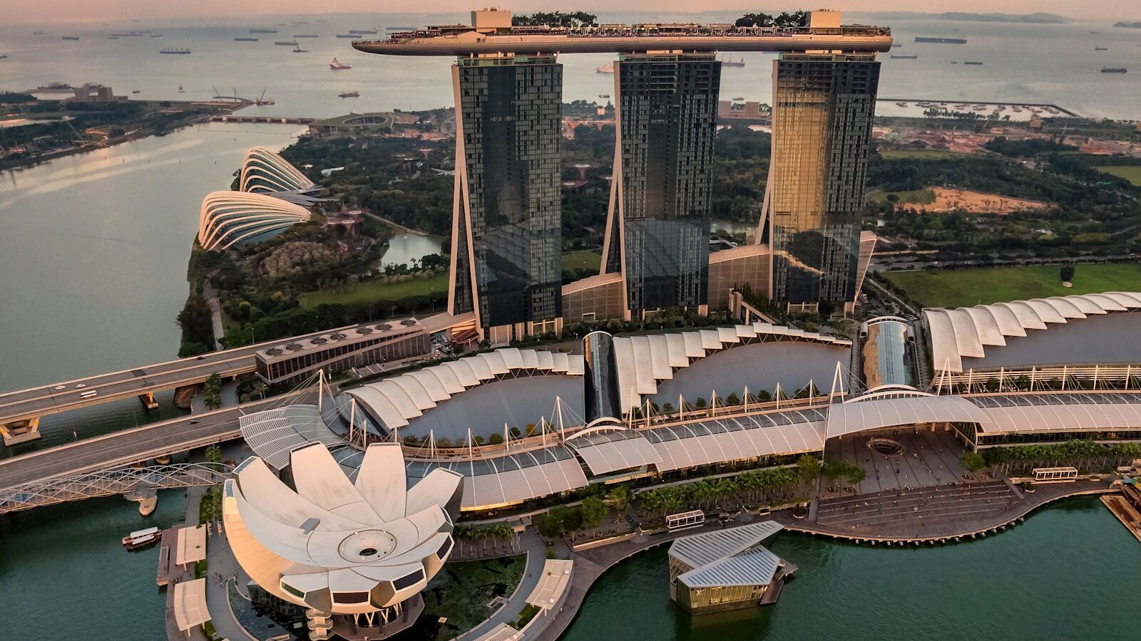
Land reclamation in Singapore, explained simply, is the practice of creating new land from the sea or from low-lying areas so that a small and crowded island has more room to build, work, and store water. Over the years this has added a meaningful amount of land to the country and shaped much of its coastline. This guide explains why Singapore reclaims land, the main methods used, what newer techniques such as empoldering involve, and how the work is planned and governed. For specific figures, locations, and current projects, official bodies such as URA and the relevant agencies are the sources to consult.
Why Singapore Reclaims Land
Singapore is one of the most densely populated countries in the world, and its natural land area is limited. As the population and economy grew, the demand for space for housing, industry, ports, airports, and recreation grew with it. Reclaiming land from the sea has been one way to meet that demand without expanding beyond the island’s shores in the conventional sense.
Reclaimed land supports many familiar parts of the country. Large areas of the east coast, parts of the city’s waterfront, major industrial zones, and land for port and aviation use have all been created or extended through reclamation. Because it changes the coastline, reclamation is closely tied to long-term planning and to how Singapore imagines its future needs decades ahead.
It is worth stressing that reclamation is a means, not an end. New land is created because there is a planned use for it, whether housing, industry, transport, or recreation, and projects are weighed against their cost, their environmental effects, and the availability of fill material. That is why reclamation is usually discussed together with the broader question of how a small island makes the best long-term use of every hectare it has.
How Land Is Traditionally Reclaimed
The classic method of reclamation is to fill in a shallow area of sea until it rises above the water and can be built on. In broad terms, the process involves several steps:
- Selecting and studying a suitable shallow coastal area, including the seabed conditions and the surrounding environment.
- Building a boundary, such as a bund or seawall, to contain the fill material and hold back the sea.
- Filling the enclosed area with material, traditionally sand and earth, until the level rises above the sea.
- Allowing the new ground to settle and strengthen, sometimes using ground improvement techniques so it can bear buildings.
- Servicing the land with drainage, roads, and utilities before development.
This infill method has been used extensively, but it depends heavily on large quantities of fill material such as sand, which has to be sourced responsibly. The need for so much fill is one reason Singapore has looked at alternative approaches that use less material.
Empoldering and the Polder Method
A newer approach used in Singapore is empoldering, which creates a polder. A polder is an area of low-lying land that sits below the level of the surrounding sea and is kept dry by a protective structure and a water management system, rather than by being filled up above sea level.
In an empoldering project, a strong dike or sea wall encloses an area, and instead of filling that area with vast amounts of sand to raise it above the sea, the water inside is drained and managed. Pumps, drains, and a network to handle rainwater keep the enclosed land usable, while the dike holds back the sea. The main advantage often cited is that a polder needs far less fill material than traditional reclamation, because the land is kept dry rather than built up. The trade-off is that a polder relies on continuous water management and well-maintained defences.
| Feature | Traditional infill reclamation | Empoldering (polder) |
|---|---|---|
| Basic idea | Fill the sea area up above sea level | Wall off an area and keep it drained |
| Land level | Above the surrounding sea | Can sit below the surrounding sea |
| Fill material needed | Large quantities of sand and earth | Much less fill material |
| Ongoing needs | Standard maintenance | Continuous drainage and dike upkeep |
Planning, Rules, and the Environment
Reclamation is not something done casually. It is planned within Singapore’s long-term land use framework, in which the Urban Redevelopment Authority sets out how land is expected to be used over the medium and longer term. Individual projects involve engineering studies, environmental assessments, and coordination among agencies responsible for coasts, drainage, the environment, and the specific use the land is intended for.
Several considerations shape modern reclamation:
- Sourcing fill material responsibly, since sand is a finite resource and its extraction has environmental effects.
- Protecting marine habitats and water quality, which is assessed before and during projects.
- Designing coastal defences that can cope with the sea, including the long-term challenge of rising sea levels.
- Fitting the new land into wider plans for housing, industry, transport, and recreation.
Because coastlines and plans change, and because projects run for years, the details of any specific reclamation, including its size, timing, and method, should be checked against current official information rather than assumed.
Reclamation and Coastal Protection
In recent years, reclamation has become linked to coastal protection. As the sea level is expected to rise over the long term, low-lying Singapore has studied how to defend its shores, and some measures combine new land with protective structures. This means reclamation is increasingly discussed not only as a way to gain space but also as part of keeping existing land safe. The precise strategies are developed by the responsible agencies and continue to evolve, so official updates are the place to follow them.
Understood together, these points show that land reclamation in Singapore is a deliberate, long-planned response to being a small island with big needs. It has literally reshaped the map, and newer methods such as empoldering reflect an effort to keep growing usable land while using fewer resources and preparing for a changing climate.
Explore More
To see how new and existing land is being reshaped, read about the Greater Southern Waterfront and the plan for Jurong Lake District, both large districts that depend on careful long-term land planning. These projects share the same underlying goal as reclamation: making the most of limited land on a small and crowded island.